


Lincoln Trail Area Development District (West) PUMA, Kentucky
About
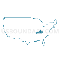
Outline
+PUMA%2c+Kentucky_A280.png)
Summary
| Unique Area Identifier | 192999 |
| Name | Lincoln Trail Area Development District (West) PUMA |
| State | Kentucky |
| Area (square miles) | 1,847.32 |
| Land Area (square miles) | 1,791.12 |
| Water Area (square miles) | 56.20 |
| % of Land Area | 96.96 |
| % of Water Area | 3.04 |
| Latitude of the Internal Point | 37.70184440 |
| Longtitude of the Internal Point | -86.27447460 |
Maps
+PUMA in Kentucky.png)
Graphs
Select a template below for downloading or customizing gragh for Lincoln Trail Area Development District (West) PUMA, Kentucky
+PUMA%2c+Kentucky_T0.png)
+PUMA%2c+Kentucky_T1.png)
+PUMA%2c+Kentucky_T2.png)
+PUMA%2c+Kentucky_T3.png)
+PUMA%2c+Kentucky_T4.png)
+PUMA%2c+Kentucky_T5.png)
+PUMA%2c+Kentucky_T6.png)
+PUMA%2c+Kentucky_T7.png)
+PUMA%2c+Kentucky.png)
Neighbors
Neighoring Public Use Microdata Area (by Name) Neighboring Public Use Microdata Area on the Map
- Barren River Area Development District (Outer) PUMA, KY
- Dubois, Knox, Spencer, Perry, Pike & Crawford Counties PUMA, IN
- Floyd, Harrison & Washington Counties PUMA, IN
- Green River Area Development District (Northeast)--Daviess & Hancock Counties PUMA, KY
- Green River Area Development District (Southwest) PUMA, KY
- KIPDA Area Development District (Southeast) PUMA, KY
- KIPDA Area Development District (West)--Louisville/Jefferson County (Southwest) PUMA, KY
- Lincoln Trail Area Development District (East) PUMA, KY
Top 10 Neighboring County (by Population) Neighboring County on the Map
- Jefferson County, KY (741,096)
- Hardin County, KY (105,543)
- Bullitt County, KY (74,319)
- Harrison County, IN (39,364)
- Meade County, KY (28,602)
- Grayson County, KY (25,746)
- Ohio County, KY (23,842)
- Breckinridge County, KY (20,059)
- Perry County, IN (19,338)
- Hart County, KY (18,199)
Top 10 Neighboring County Subdivision (by Population) Neighboring County Subdivision on the Map
- Elizabethtown CCD, Hardin County, KY (49,288)
- Radcliff CCD, Hardin County, KY (37,359)
- Shepherdsville Northwest CCD, Bullitt County, KY (34,819)
- South Dixie CCD, Jefferson County, KY (24,955)
- Leitchfield CCD, Grayson County, KY (13,527)
- Brandenburg CCD, Meade County, KY (12,805)
- Harrison township, Harrison County, IN (12,484)
- Flaherty CCD, Meade County, KY (12,337)
- Fort Knox CCD, Hardin County, KY (7,444)
- McDaniels-Hudson CCD, Breckinridge County, KY (5,437)
Top 10 Neighboring Place (by Population) Neighboring Place on the Map
- Louisville/Jefferson County metro government (balance), KY (597,337)
- Elizabethtown city, KY (28,531)
- Radcliff city, KY (21,688)
- Fort Knox CDP, KY (10,124)
- Leitchfield city, KY (6,699)
- Vine Grove city, KY (4,520)
- Brandenburg city, KY (2,643)
- Hardinsburg city, KY (2,343)
- Doe Valley CDP, KY (1,931)
- Lebanon Junction city, KY (1,813)
Top 10 Neighboring Elementary School District (by Population) Neighboring Elementary School District on the Map
Top 10 Neighboring Secondary School District (by Population) Neighboring Secondary School District on the Map
Top 10 Neighboring Unified School District (by Population) Neighboring Unified School District on the Map
- Jefferson County School District, KY (738,704)
- Hardin County School District, KY (85,779)
- Bullitt County School District, KY (74,319)
- Grayson County School District, KY (25,746)
- Meade County School District, KY (24,972)
- Ohio County School District, KY (23,842)
- South Harrison Community Schools, IN (21,146)
- Breckinridge County School District, KY (18,642)
- Hart County School District, KY (15,438)
- Butler County School District, KY (12,690)
Top 10 Neighboring State Legislative District Lower Chamber (by Population) Neighboring State Legislative District Lower Chamber on the Map
- State House District 70, IN (72,273)
- State House District 73, IN (62,643)
- State House District 74, IN (61,219)
- State House District 25, KY (51,532)
- State House District 14, KY (45,708)
- State House District 27, KY (44,833)
- State House District 19, KY (44,553)
- State House District 18, KY (43,650)
- State House District 17, KY (42,990)
- State House District 28, KY (41,513)
Top 10 Neighboring State Legislative District Upper Chamber (by Population) Neighboring State Legislative District Upper Chamber on the Map
- State Senate District 20, KY (133,454)
- State Senate District 47, IN (128,339)
- State Senate District 32, KY (126,482)
- State Senate District 10, KY (120,533)
- State Senate District 5, KY (115,364)
- State Senate District 9, KY (112,974)
- State Senate District 6, KY (102,261)
Top 10 Neighboring 111th Congressional District (by Population) Neighboring 111th Congressional District on the Map
- Congressional District 2, KY (760,032)
- Congressional District 9, IN (729,076)
- Congressional District 1, KY (686,989)
Top 10 Neighboring Census Tract (by Population) Neighboring Census Tract on the Map
- Census Tract 9.01, Hardin County, KY (9,908)
- Census Tract 16, Hardin County, KY (9,402)
- Census Tract 17, Hardin County, KY (8,881)
- Census Tract 10.02, Hardin County, KY (8,344)
- Census Tract 9704.02, Meade County, KY (7,559)
- Census Tract 9504, Grayson County, KY (6,924)
- Census Tract 606, Harrison County, IN (6,881)
- Census Tract 10.01, Hardin County, KY (6,762)
- Census Tract 9703.02, Meade County, KY (5,629)
- Census Tract 4, Hardin County, KY (5,387)
Top 10 Neighboring 5-Digit ZIP Code Tabulation Area (by Population) Neighboring 5-Digit ZIP Code Tabulation Area on the Map
- 42701, KY (48,194)
- 40272, KY (37,394)
- 40160, KY (23,574)
- 47112, IN (16,722)
- 42754, KY (15,349)
- 40175, KY (13,070)
- 40108, KY (11,583)
- 42261, KY (10,602)
- 40121, KY (10,124)
- 40162, KY (6,056)